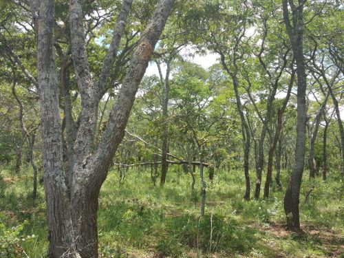
Chimaliro Forest Reserve was designated and gazette as a forest reserve by the Malawi Government in 1926. It is a beautiful forest reserve covered with indigenous brachystegia woodland and grassland in some parts.

Kaningina Forest Reserve is a forest reserve and is located in Nkhata Bay District, Northern Region, Malawi. The estimate terrain elevation above seal level is 1264 metres.

Lake Malawi National Park is a 29.600 km2 national park at the southern end of Lake Malawi in Malawi. It is the only national park in Malawi that was created with the purpose of protecting fish and aquatic habitats. Lake Malawi National Park includes a fair amount of land, including a headland, the foreshore and several small rocky islands in Lake Malawi.
The Lake Malawi National Park incorporates the beautiful Cape Maclear, a World Heritage Site. The park lies in the south of the country, and is the world's first freshwater park. It includes the land area around the cape and bay, as well as the Lake and islands as far as 100 metres offshore. Lake Malawi is the number 2 deepst lake in Africa and number 6 deepest lake in the world (2316 feet or 706 meter).
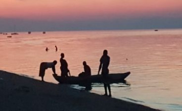
These waters are an absolute delight for snorkelling and diving enthusiasts. There is also boating and canoeing on offer. There are 600 species of the colourful Malawi Cichlids, which are endemic here. This diversity of freshwater fish is unequalled in the entire world. The abundant freshwater fish will feed directly from your hand while snorkelling in Lake Malawi.
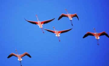
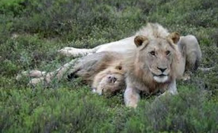
In the surrounding areas, various animals and birds can be found, including Baboons, antelope, Hyrax, Fish eagles, Hamerkops and Cormorants. There are a number of excellent places to stay, all of which offer many exciting activities. There are even some beautiful romantic island hideaways.
For more information, click here.

Lake Malawi National Park is a 29.600 km2 national park at the southern end of Lake Malawi in Malawi. It is the only national park in Malawi that was created with the purpose of protecting fish and aquatic habitats. Lake Malawi National Park includes a fair amount of land, including a headland, the foreshore and several small rocky islands in Lake Malawi.
The Lake Malawi National Park incorporates the beautiful Cape Maclear, a World Heritage Site. The park lies in the south of the country, and is the world's first freshwater park. It includes the land area around the cape and bay, as well as the Lake and islands as far as 100 metres offshore. Lake Malawi is the number 2 deepst lake in Africa and number 6 deepest lake in the world (2316 feet or 706 meter).
These waters are an absolute delight for snorkelling and diving enthusiasts. There is also boating and canoeing on offer. There are 600 species of the colourful Malawi Cichlids, which are endemic here. This diversity of freshwater fish is unequalled in the entire world. The abundant freshwater fish will feed directly from your hand while snorkelling in Lake Malawi.
In the surrounding areas, various animals and birds can be found, including Baboons, antelope, Hyrax, Fish eagles, Hamerkops and Cormorants. There are a number of excellent places to stay, all of which offer many exciting activities. There are even some beautiful romantic island hideaways.
For more information, click here.
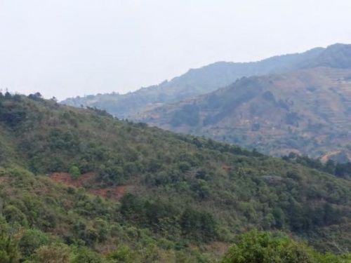
The Misuku Hills lie near Malawi's northern border. They are bounded on the north by the Songwe River, which forms Malawi's northern border with Tanzania. Tanzania's Umalila Mountains lie north of the Songwe.
On the east and south, the Misuku hills transition to a hilly plateau that slopes towards Lake Malawi. The valley of the Kaseye River, a northward-flowing tributary of the Songwe, bounds the hills on the west. The Chitipa Plain lies to the southwest.
The tallest peaks are Matipa (2124 m) and Mughese (1909 m).
For more information, click here.
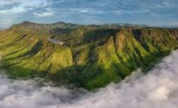
Nyika National Park is the first (1965) and largest Park in Malawi. Most parts lie about 2 000 metres above sea level. The plateau is perfect for hiking, mountain biking, unconventional 4 x 4 drives, game drives and horseback safaris, as well as walks through the long grass. Fishing (catch and release) can also be done.
The park covers practically most (3000 km2) of the Nyika Plateau in northern Malawi, about 480 km north of Lilongwe and 60 km north of Rumphi by road. Access is by a single dirt road which branches north off the road from Rumphi to the Katumbi border post, and winds its way up the south-western scarp of the plateau, continues over the top, where it forms the border with Zambia (where Nyika continues), then descends the north-west scarp in a series of bends, and continues north to the Chisenga border post. On the top of the plateau, a spur goes east to Chelinda, the only setlement where you can find the headquarters of the park. There is no access from the eastern side.
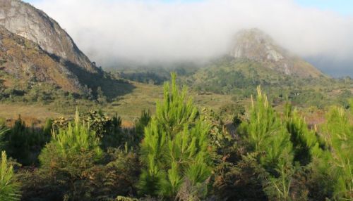
The name Nyika means "where the water comes from" as the plateau's elevation makes it wetter than surrounding areas. Other suggested meanings are "wilderness" and "short grassland". The top is Nganda Peak (2605 m) and is frequently in cloud, both in the rainy season and in the cold dry season when dense fogs, called Chiperoni, may persist well into the morning and sometimes all day. The persistent moisture brings over 200 types of orchid into flower, the highest concentration in south east Africa. The grasslands of Nyika are rich in wildflowers all through the year but especially from January to April during the rains.
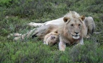
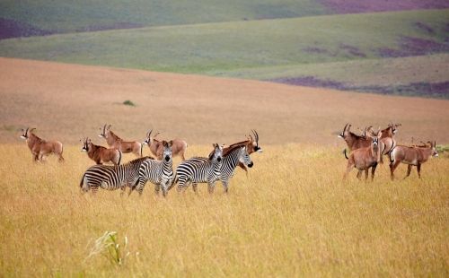
On the high plateau you can find Zebra , bushbucks, reebucks, warthogs, large numbers of antilope and it is reputed to have the highest concentration of Leopard in Central Africa. Elephant and bufallo live on the lower ground; however this area is not easily accessible. On night drives various animals can be seen, including Hyena, Jackal and Owls or maybe even Leopards. 400 species of bird have been recorded in Nyika.
There is a small airstrip near Chelinda Camp for access by air, otherwise the drive from Rumphi is uncomplicated, although it is mostly on dirt roads which are very rough, and a 4x4 vehicle is a must during the rainy season.
For more information, click here.
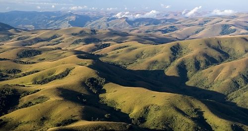
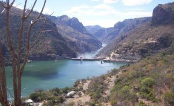
The Nyika Plateau lies in northern Malawi, with a small portion in north eastern Zambia. Most of it lies at elevations of between 2,100 and 2,200 m (6,900 and 7,200 ft), the highest point being 2,605 m (8,547 ft) at Nganda Peak. It is roughly a diamond in shape, with a long north–south axis of about 90 km (56 mi), and an east–west axis of about 50 km (31 mi). It towers above Lake Malawi (elevation 475 m (1,600 ft)), and the towns of Livingstonia and Chilumba. Its well-defined north-west escarpment rises about 700 m (2,300 ft) above the north-eastern extremity of the Luangwa Valley, and its similarly prominent south-east escarpment rises about 1,000 m (3,300 ft) above the South Rukuru River valley.] It is very different in scenery from other parts of Malawi, consisting of rolling hills with little streams in broad valleys, and rough grassland with clumps of pine trees.
For more information, click here.
Established in 1948, has an area of approx. 1150 km², covering much of the southern range of the Viphya Mountains,
The range runs north-northeast along the west shore of Lake Malawi. The South Rukuru drains northeastwards into Lake Malawi, and the river's lower valley defines northern end of the range, separating the Viphya Mountains from the Nyika Plateau north of the river. The eastern slopes are drained by the Luweya River and other streams which empty into Lake Malawi.
The reserve is home to the vast Viphya Plantation, also known as the Chikangawa Forest, which is mostly composed of exotic pine trees. The South Viphya Forest Reserve also includes three enclaves of native evergreen montane forest at Nthungwa at 1,600–1,800 m, Chamambo at 1,600–1,800 m and Kawandama at 1,750–1,850 m.
Other forest reserves include Chimaliro and Dwambazi at the south end of the range, Mtangatanga and Perekezi on the western slope of the southern range, Ruvuo, Chisahira, and Nkhwazi on the eastern slope, Lunyangwa and Kaning'ina near Mzuzu, and Uzumara on Mt. Uzumara in the northern range.
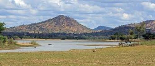
Vwaza Marsh Game Reserve is a national game reserve in Malawi. Vwaza is managed by Peace Parks Foundation and is located in Malawi’s Northern Region and makes up part of the Malawi-Zambia Transfrontier Conservation Area which spans over 30.000km2.. Habitats range from large miombo woodland to open wetlands. In contrast to the Nyika National Park on the Nyika Plateau, much of Vwaza is located on low-lying flat ground although the eastern side of the park is hilly. It is located to the southeast of the plateau and to the north of the floodplains of South Rukuru River and covers an area of 1.000 m2. The reserve is a rewarding experience because of the stunning scenery and high concentration of game, including Hippo, Elephants, Lions, Buffalo and Leopards etc.
There are 5 challets containing two beds, toilet and bathroom. They have a kitchen where you bring your own food and the cook will prepare it for free. Game safari available but in your own vehicle. Walking safari is also an option. This reserve lies in the north of the country on the Zambian border, and is a backpacker's delight. It is accessible from Rumphi by car or public transport. Mvaza is a backpacker's delight and is accessible from Rumphi by car or public transport.
There are wonderful walks around Lake Kazuni (you must be accompanied by a game ranger) as well as 4x4 trails around the reserve. Animals resident around the lake include: many Hippos, Elephant and Buffalo. Many other smaller animals can also be seen, and the birdlife is excellent, with around 300 species recorded in the reserve including stork, heron and the white-faced tree duck.